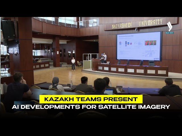
Artificial intelligence technologies are increasingly being used for processing satellite imagery and digital terrain analysis. The final of the NURIS Hardware Challenge 6.0 was held at Nazarbayev University, where AI developments for the automatic recognition of buildings, roads, water bodies, and green areas in satellite images were presented. Teams from all regions of Kazakhstan worked on the projects. In total, 35 applications were submitted to the competition, and six finalists were selected. Participants developed solutions based on a request from a domestic company engaged in digital mapping and the creation of geoportals. According to the organizers, such technologies can be used in urban planning, monitoring engineering networks, and emergency prevention. The winning team will have the opportunity to commercialize their idea and implement their project in the company’s operations.
«Following the event, KazAeroSpace, the industrial partner, will select
the best project for implementation within its production processes. The
solution focuses on developing AI-powered software for the in-depth analysis of
satellite imagery, designed to improve operational efficiency,» noted Abzal Daribayev, Managing Director for Innovation, Astana Business
Campus.
Related Articles