For the first time in Kazakhstan, scientists have digitized
groundwater reserves. Their research into sources has resulted in a digital
Atlas of hydrogeological maps. To compile it, specialists from the Institute of
Hydrogeology and Geoecology in Almaty drew on data from the geodetic service
and other agencies. The system contains information about salt and fresh water
in each region. According to its creators, this digital platform will help
effectively manage water resources and make decisions to address moisture
shortages.
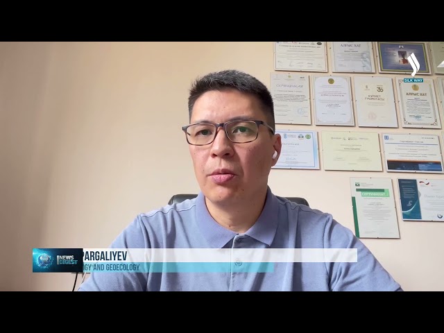
«Groundwater is one of the most critical minerals and a
strategic asset for ensuring water security in Kazakhstan. That’s why it
receives such close attention from researchers. Amid rising water demand and
climate change, the atlas could become a key tool for the efficient use,
protection, and management of water resources. The maps clearly show the state,
quality, and distribution of groundwater, along with reserve volumes. Moreover,
the new atlas will enable more precise assessments and use of underground
reserves, including geothermal and mineral waters, as well as the
hydrogeological conditions of the country, which are closely tied to
environmental factors,» said Daniyar Sapargaliyev, Executive Secretary of the Institute
of Hydrogeology and Geoecology.
Scientists also point out that in the face of climate
change, the atlas will help forecast water shortage risks and prevent negative
outcomes. It will additionally serve as an objective foundation for allocating
resources among Kazakhstan’s regions.
Related Articles